
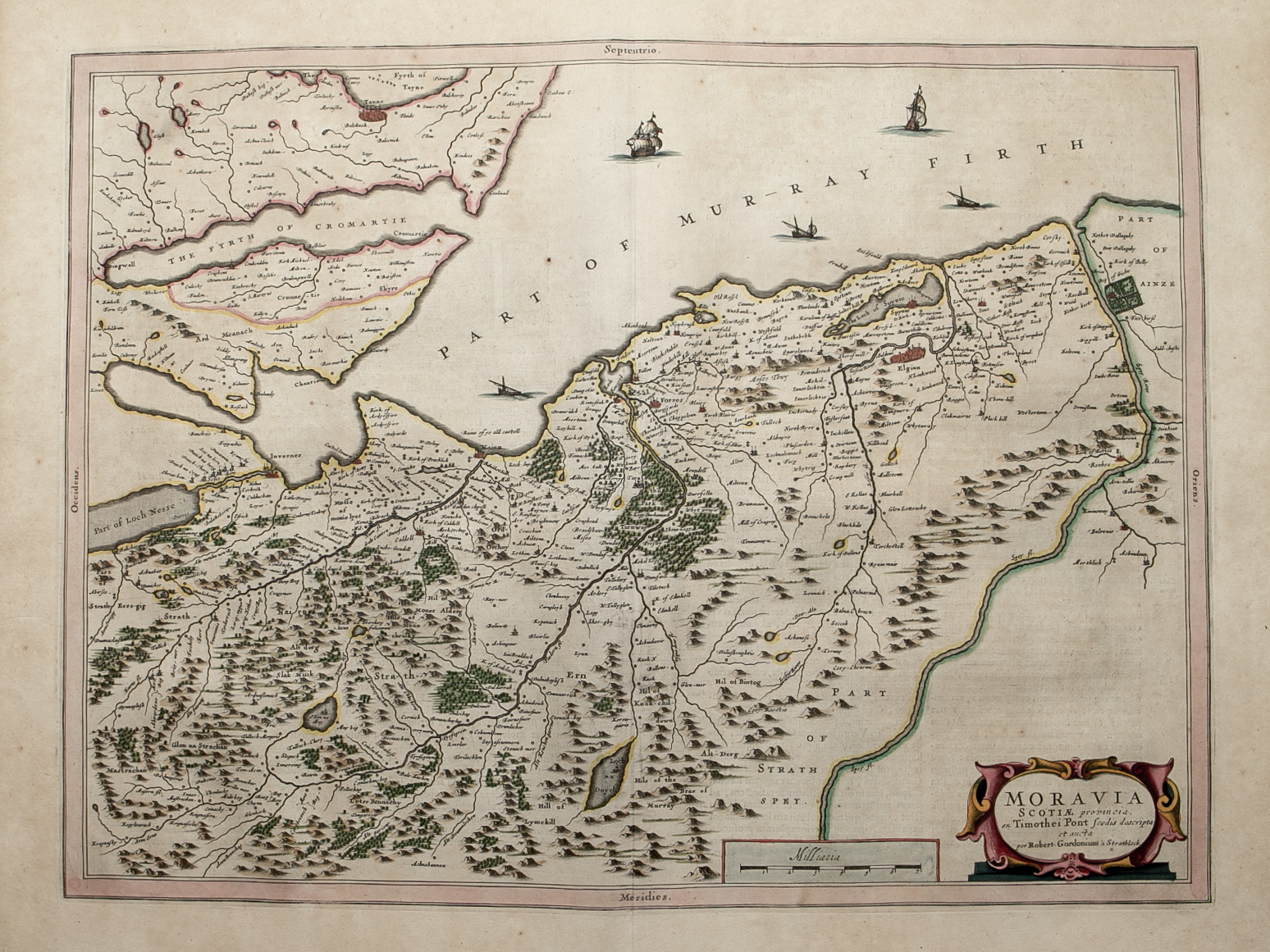
Moravia Scotiae provincial …….
£325.00
sold out
Cartographer / Engraver: Robert Gordon after Timothy Pont
Medium / Size: Copperplate engraved map / c.425 x 565mm
Date: 1662
Cartographer / Engraver: Robert Gordon after Timothy Pont
Medium / Size: Copperplate engraved map / c.425 x 565mm
Date: 1662
Cartographer / Engraver: Robert Gordon after Timothy Pont
Medium / Size: Copperplate engraved map / c.425 x 565mm
Date: 1662
Brief Description: Covers part of Morayshire, Nairnshire, part of Inverness-shire and part of Easter Ross; main towns mapped include Elgin, Forres, Nairn and Inverness; original colour; Latin text verso; excellent condition


