Sutherland Shire – published by John Thomson in his Atlas of Scotland
£85.00
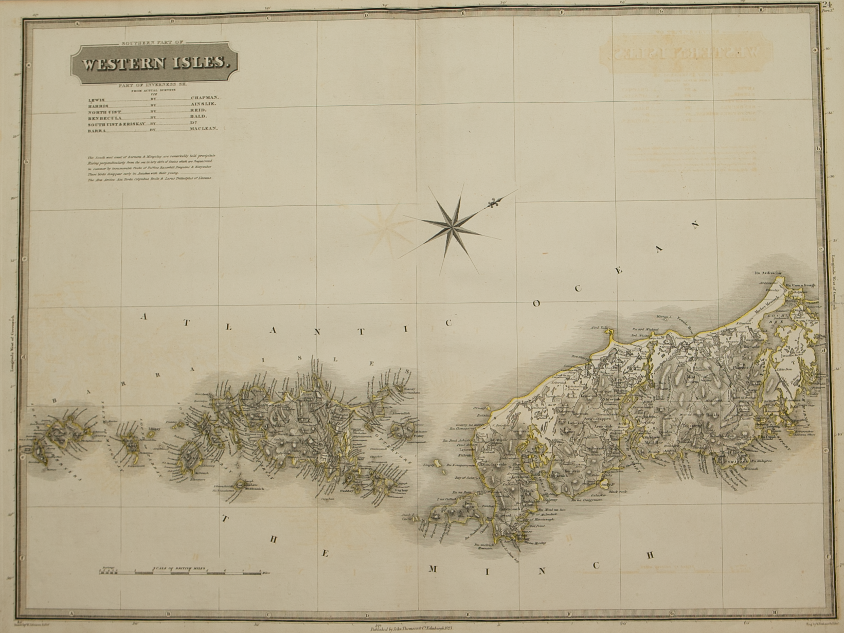
Cartographer / Engraver: ----- / S.I. Neele & Son, London
Medium / Size: copperplate engraved map / c.530 x 680mm
Date: 1823
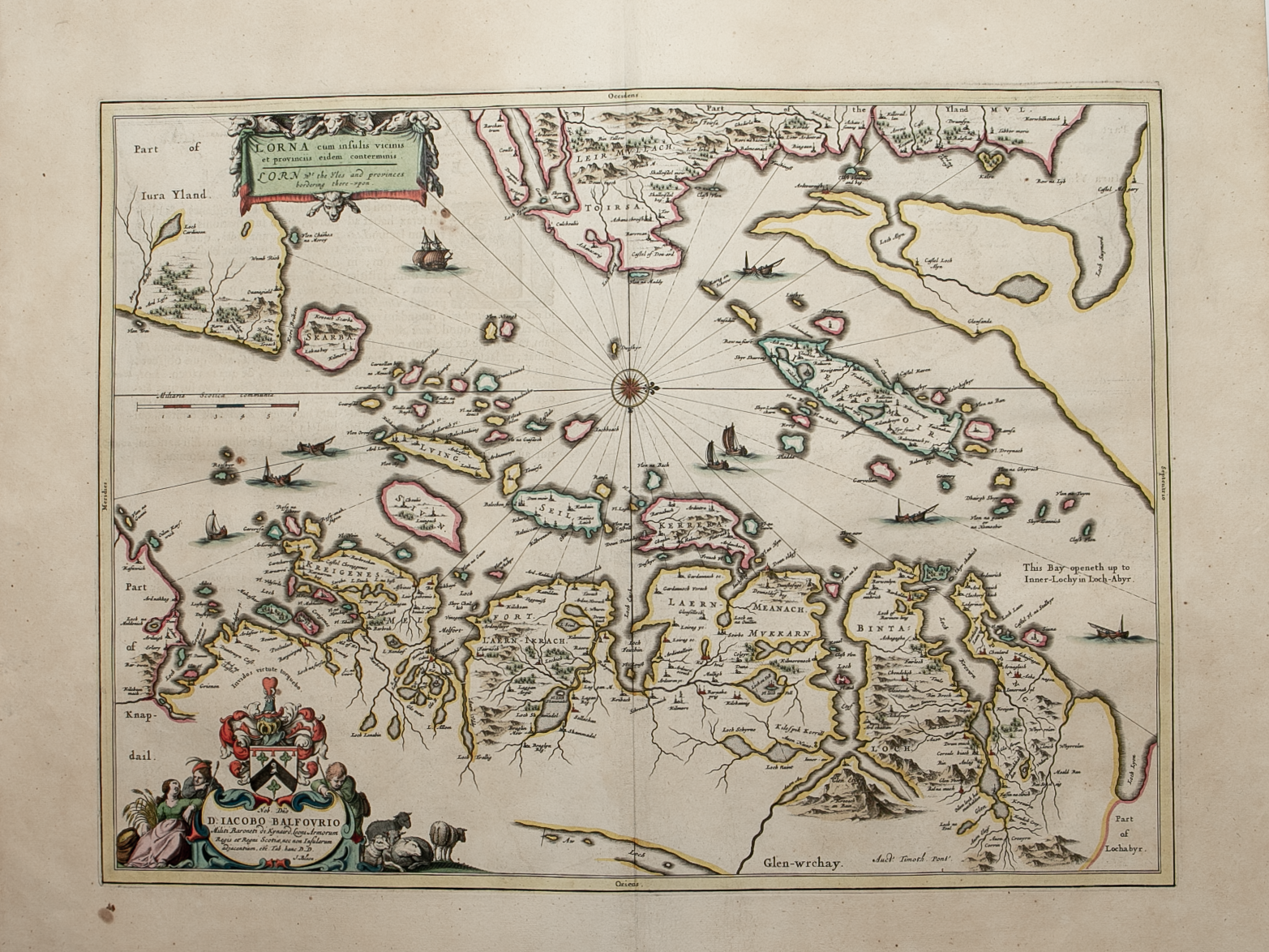
Cartographer / Engraver: ----- / S.I. Neele & Son, London
Medium / Size: copperplate engraved map / c.530 x 680mm
Date: 1823
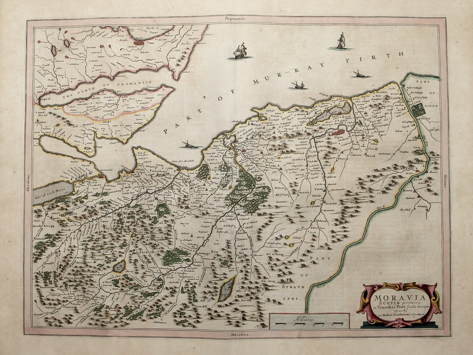
Cartographer / Engraver: ----- / S.I. Neele & Son, London
Medium / Size: copperplate engraved map / c.530 x 680mm
Date: 1823
Brief Description: The north west highland region of Scotland bordered by numerous sea lochs; original outline colour; very good condition