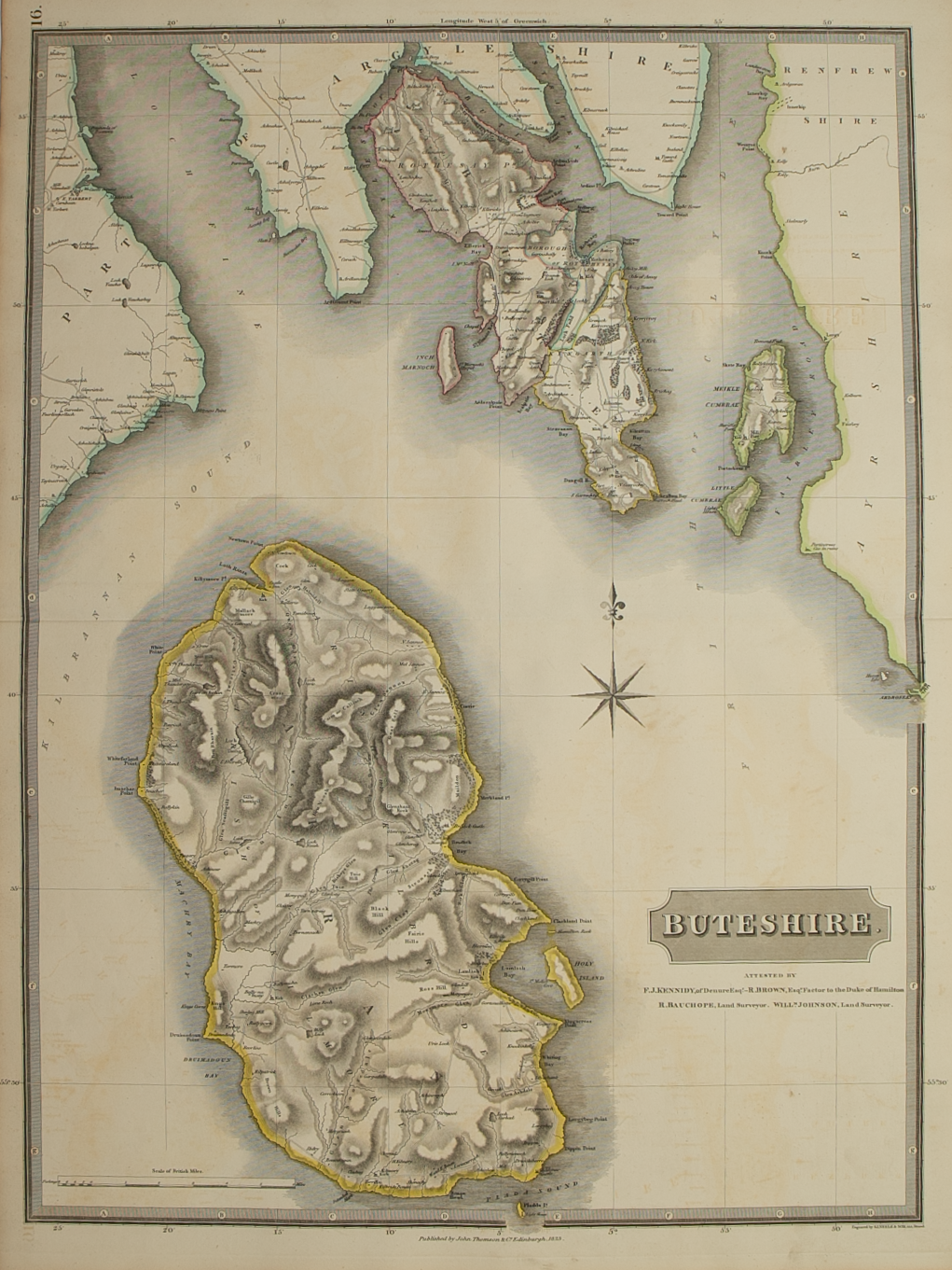
Ivra Insula………
£275.00
Cartographer / Engraver: Timothy Pont
Medium / Size: Copperplate engraved map /c.420 x 535mm
Date: 1662
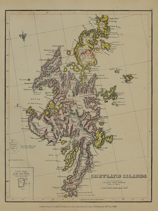
Cartographer / Engraver: Timothy Pont
Medium / Size: Copperplate engraved map /c.420 x 535mm
Date: 1662
Cartographer / Engraver: Timothy Pont
Medium / Size: Copperplate engraved map /c.420 x 535mm
Date: 1662
Brief Description: Jura is one of the least accurate maps in the Scottish Blaeu atlases – the island is located off the Scottish mainland southeast of the Island of Mull; original colour; Latin text verso; vertical crease c.90mm from right edge of map; attractive, acceptable condition