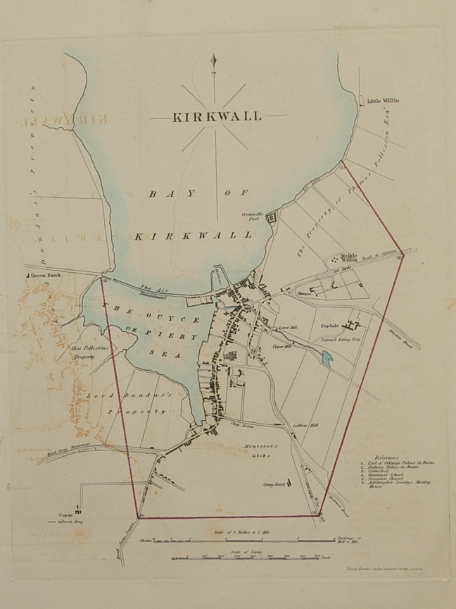
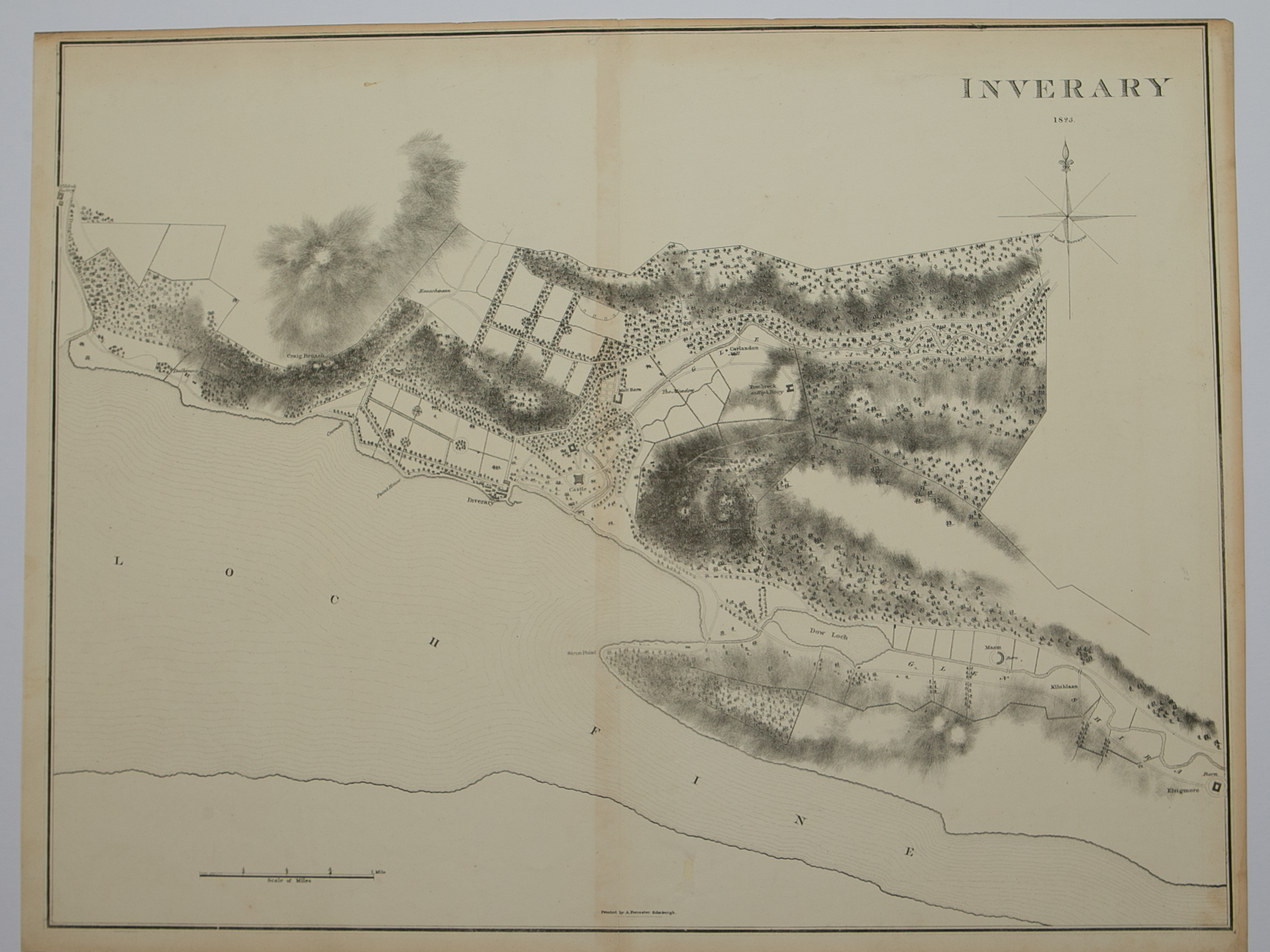
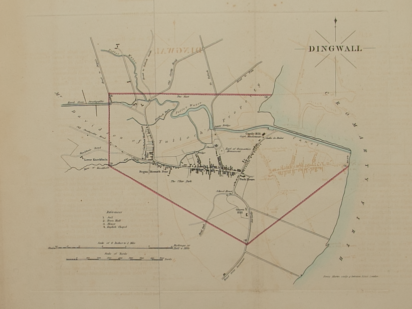
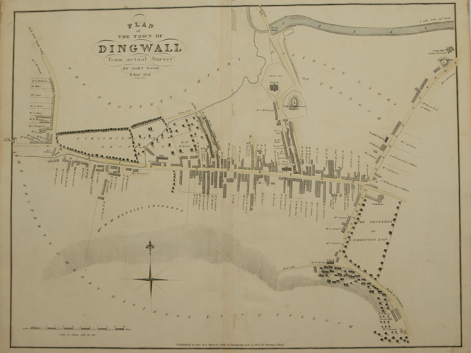
Plan of Rothesay from actual survey by John Wood, Edinburgh 1825
£50.00
Cartographer / Engraver: John Wood / T. Clerk
Medium / Size: copperplate engraved plan / c.470 x 520mm
Date: 1825
Cartographer / Engraver: John Wood / T. Clerk
Medium / Size: copperplate engraved plan / c.470 x 520mm
Date: 1825
Cartographer / Engraver: John Wood / T. Clerk
Medium / Size: copperplate engraved plan / c.470 x 520mm
Date: 1825
Brief Description: Plan is 1 of 48 town plans issued in John Wood’s “Town Atlas of Scotland” published in 1828; Rothsay is the principal town on the Isle of Bute; professional repairs to plan centrefold, otherwise good condition