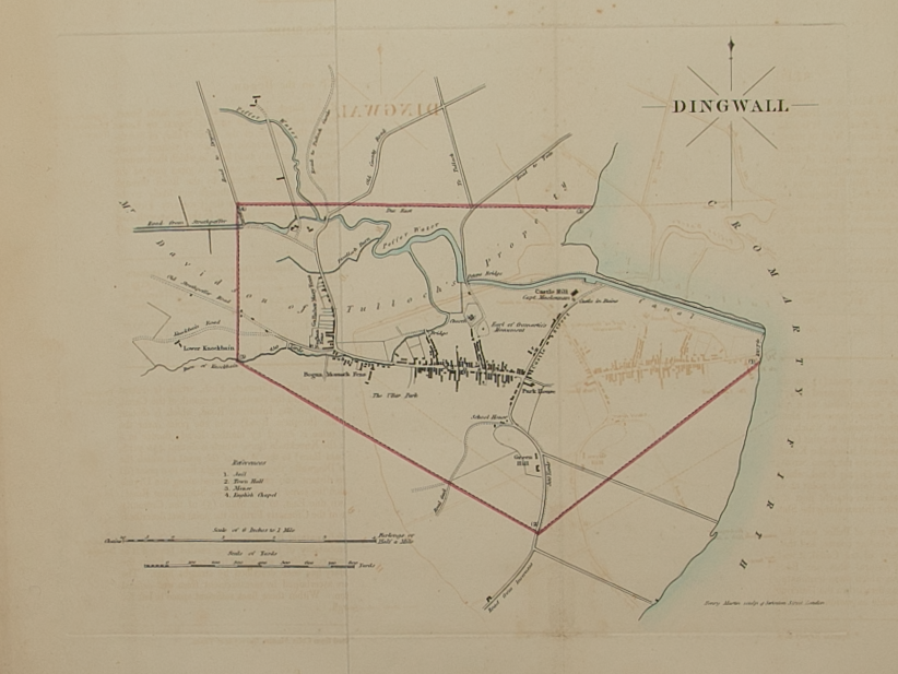
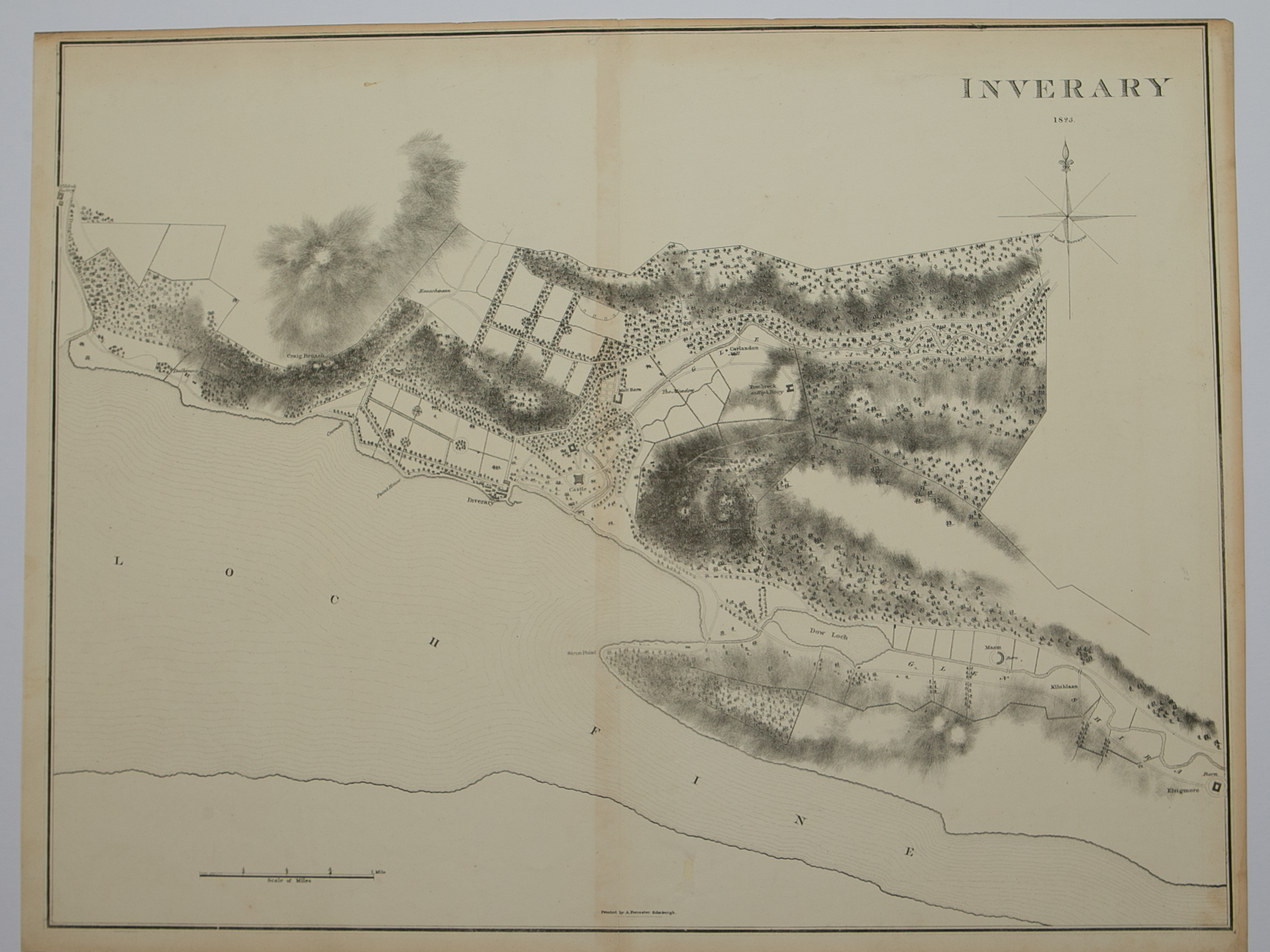
Skip to Content
Scottish Pictures
Home
Maps
Views
Other Prints
Delivery
Contact
0
0
Scottish Pictures
Home
Maps
Views
Other Prints
Delivery
Contact
0
0
Home
Maps
Views
Other Prints
Delivery
Contact
Town Plans Inverary 1825
BZ4R5711.png Image 1 of
BZ4R5711.png

Inverary 1825

£50.00

Cartographer / Engraver: John Wood / lithographer – A. Forrester, Edinburgh

Medium / Size: lithograph / c.515 x 670mm

Date: 1825

Add To Cart

Cartographer / Engraver: John Wood / lithographer – A. Forrester, Edinburgh

Medium / Size: lithograph / c.515 x 670mm

Date: 1825

Cartographer / Engraver: John Wood / lithographer – A. Forrester, Edinburgh

Medium / Size: lithograph / c.515 x 670mm

Date: 1825

Brief Description: Plan is 1 of 48 town plans issued in John Wood’s “Town Atlas of Scotland” published in 1828; the “plan” is not strictly a town plan but a map of the environs of the town & Inverary Castle on the shore of Loch Fine; trimmed to near neatline on top margin, otherwise very good condition 

You Might Also Like

BZ4R5705.png
Plan of the Town of Dingwall from actual survey by John Wood in 1821
£55.00
BZ4R6050.png BZ4R6050.png
Plan of Campbeltown
£35.00
BZ4R6084.png BZ4R6084.png
Plan of Inverary
£35.00
BZ4R6078.png BZ4R6078.png
Plan of Fortrose and Rosemarkie
£25.00
BZ4R6062.png BZ4R6062.png
Plan of Dingwall
£40.00
Email Us


Trading Terms & Customer Information


Scottish Pictures

Email: ian@scottishpictures.com


Privacy Policy

BZ4R5711.png