
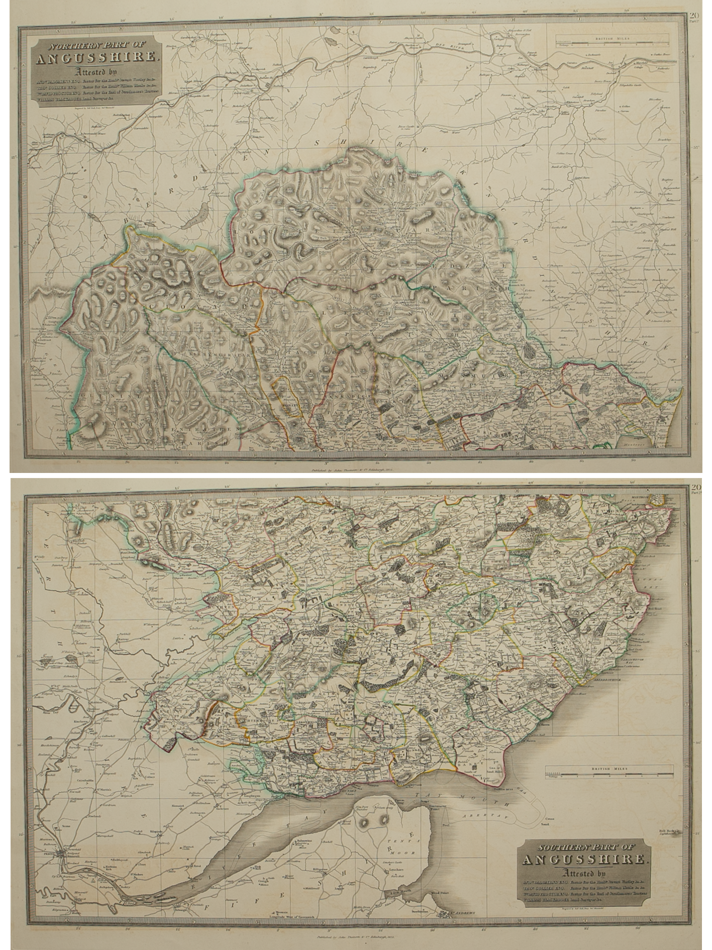


Northern and Southern parts of Angus-shire – published by John Thomson in his Atlas of Scotland
£175.00
Cartographer / Engraver: Wm. Blackadder / Sidney Hall, London
Medium / Size: copperplate engraved maps / both c.530 x 680mm
Date: 1825
Cartographer / Engraver: Wm. Blackadder / Sidney Hall, London
Medium / Size: copperplate engraved maps / both c.530 x 680mm
Date: 1825
Cartographer / Engraver: Wm. Blackadder / Sidney Hall, London
Medium / Size: copperplate engraved maps / both c.530 x 680mm
Date: 1825
Brief Description: County extends from Aberdeenshire & Kincardine-shire in the north to the River Tay estuary; original outline colour; wide margins, very good condition


