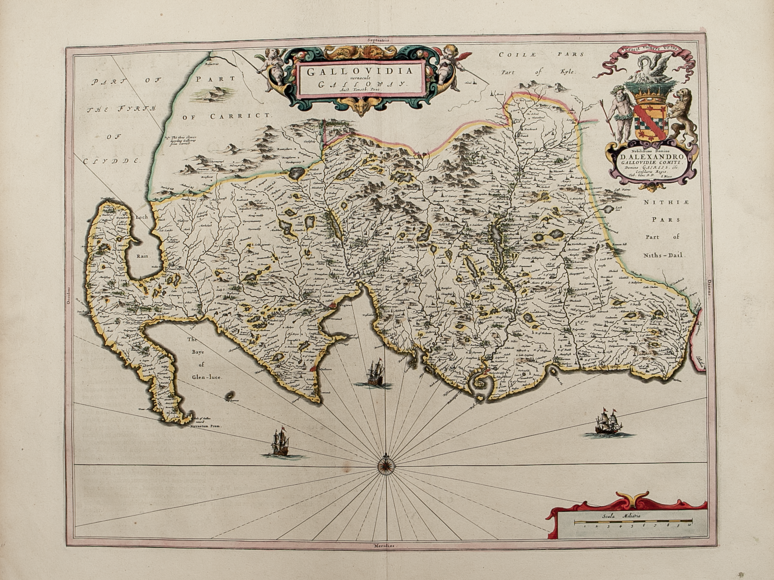
Gallovidia vernacule Galloway

£250.00

Cartographer / Engraver: Timothy Pont

Medium / Size: Copperplate engraved map / c.420 x 535mm

Date: 1662

Add To Cart

Cartographer / Engraver: Timothy Pont

Medium / Size: Copperplate engraved map / c.420 x 535mm

Date: 1662

Cartographer / Engraver: Timothy Pont

Medium / Size: Copperplate engraved map / c.420 x 535mm

Date: 1662

Brief Description: S.W. Scotland; original colour; Latin text verso; excellent condition 

Selkirk-shire – published by John Thomson in his Atlas of Scotland
£125.00
Northern and Southern parts of Roxburghshire – published by John Thomson in his Atlas of Scotland
£185.00
County of Wigton – published by John Thomson in his Atlas of Scotland
£125.00
Twedia cum vicecomitatu Etterico Forestae etiam Selkirkae dictus
£275.00
Northern and Southern parts of Dumfries-shire – published by John Thomson in his Atlas of Scotland
£185.00